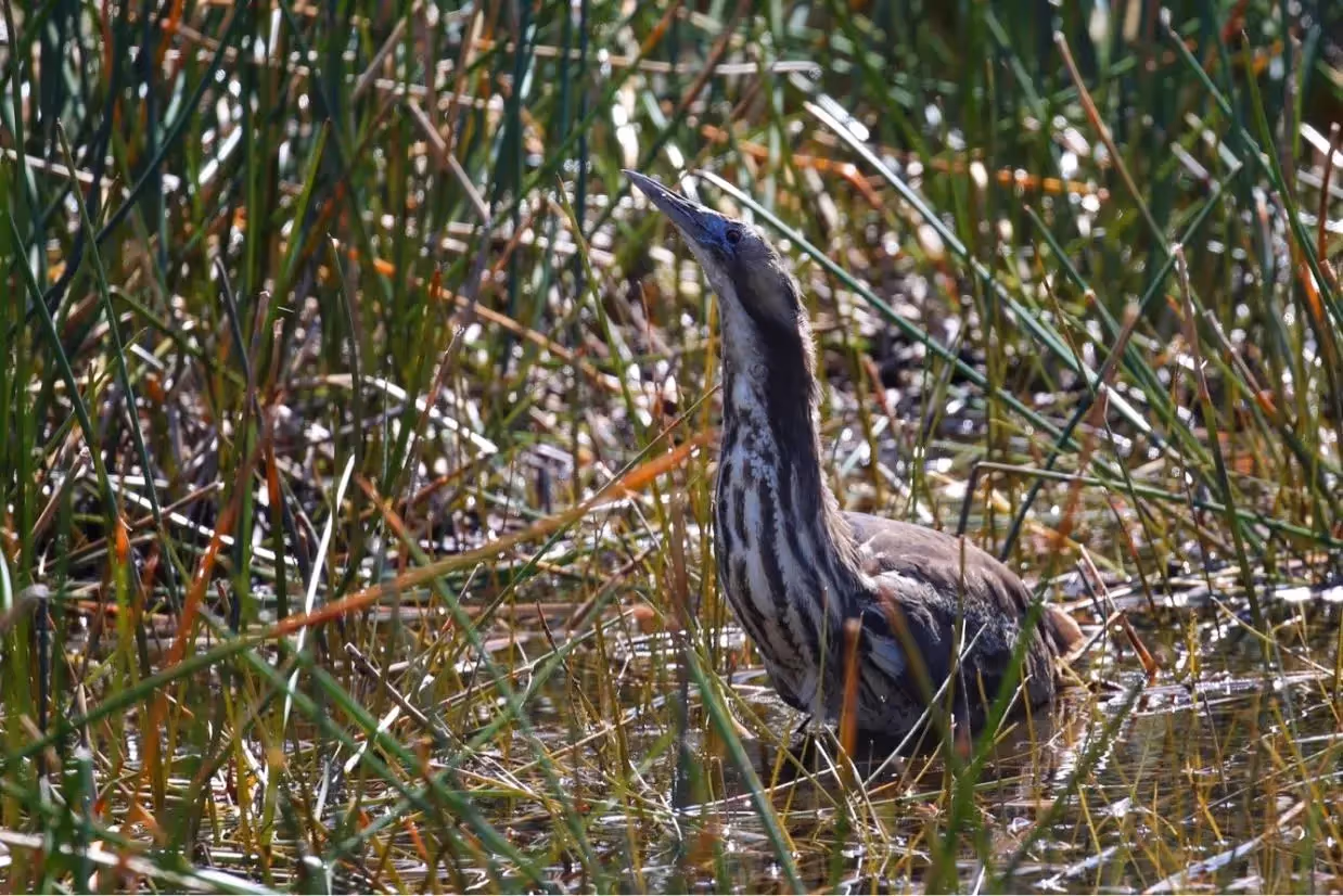
We use monitoring, evaluation and research to assess environmental outcomes and inform adaptive management, using the below indicators that reflect the health of the Basin.
Read more about our Evaluation and Research work here
River Flows and Connectivity
Native Vegetation
Waterbirds
Native Fish
Cultural Outcomes
Species Diversity
Ecosystem Diversity
Food Webs and Water Quality
We work along 10 river systems within the Basin, conducting targeted monitoring and research to understand local ecosystem responses and inform water management practices. The data is also used to help inform Basin Evaluation.
Border, Barwon & Namoi
Darling and Warrego
Goulburn River and Northern Victorian Tributaries
Gwydir
Lachlan
Lower Balonne
Lower Murray and Coorong, Lower Lakes, and Murray Mouth
Macquarie River and Marshes
Mid-Murray
Murrumbidgee
Learn more about the current research projects of the Flow-MER Program.
Acoustic recorders capture the diverse bird calls at Narran Lakes, revealing the rich avian life and helping scientists monitor and protect these vital wetlands.
A decade of monitoring in the Guwayda Wetlands reveals how environmental water supports diverse species, from frogs and fish to flowering coolibah trees.
Widespread flooding in 2022-23 triggered massive waterbird breeding events. Discover how environmental water releases ensured chicks' survival and success.
In Toorale National Park, a wet year and targeted water management create ideal conditions for diverse duck species to breed and thrive.
In the Lower Murrumbidgee Floodplain, researchers use automated call recorders to study the endangered Australasian bittern's breeding habits.
A juvenile Intermediate Egret, tracked from Australia to Papua New Guinea, reveals new insights into migration patterns and stopover sites.
Over eight years, 57 waterbird species, including the Kularku (Brolga), have been recorded in Toorale's wetlands, showcasing the area's rich biodiversity.
In the Lowbidgee Floodplain, tens of thousands of waterbirds are thriving, thanks to targeted environmental water releases and collaborative efforts.
Track the incredible journeys of Australian waterbirds with satellite technology, revealing their migration patterns and the critical habitats they rely on.
CSIRO's satellite tracking reveals the incredible journeys of waterbirds, helping us understand their movements and improve conservation efforts.
Researchers study how water management impacts waterbird breeding. Discover how environmental flows support ibis and spoonbill chicks, ensuring they have enough food to thrive and grow in their wetland habitats.
GPS-tracked waterbirds reveal their secret journeys, helping scientists protect vital habitats and boost bird populations.